LOG_aFlow – Water Flow Measurement
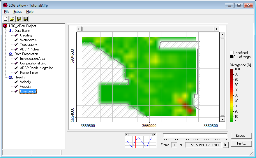
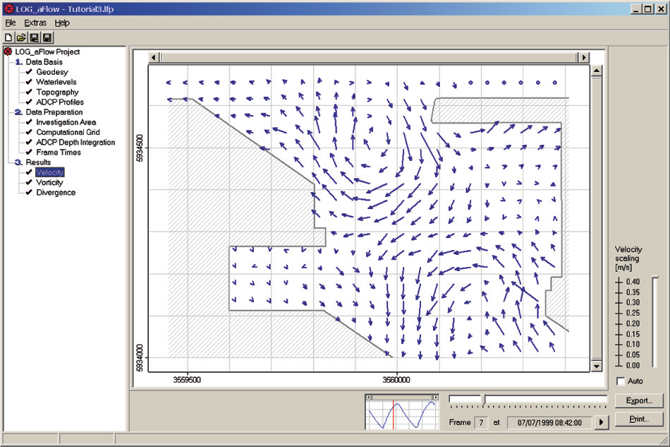
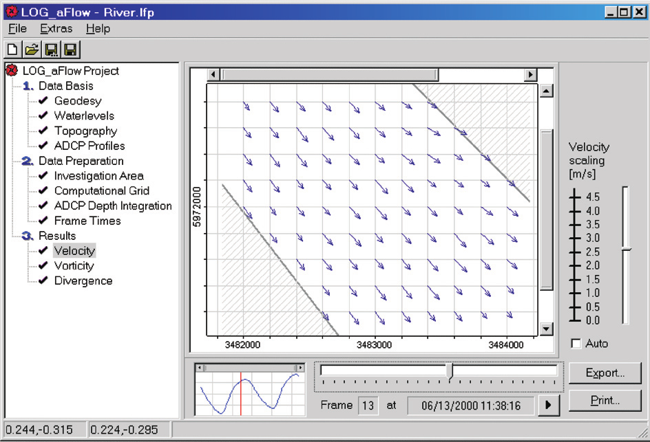
LOG_aFlow is a hydrodynamic ADCP Data Evaluation Software for rapid water flow chart generation, based on real measurements. Resulting flow charts show velocity, vorticity (turbulence) and divergence (quality) of water. The LOG_aFlow software uses a hydrodynamic model to process ADCP data, evaluate the measurement data quality and immediately generate flow charts showing velocity, vorticity (turbulence) and divergence (quality), even at tidal affected areas. The results are generated rapidly using a very simple user menu.
The resulting flow charts contain up to 5 times higher data point density compared to the original ADCP data, thus information is shown in-between survey tracks and in-between survey runs.
The LOG_aFlow software flow charts are used as maneuvering assistance for pilots (ship safety), sediment transport process investigations, discharge estimation, environmental flow investigations at changing flow conditions (areas with tides). The software provides high accuracy and resolution results in seconds, without the need of specialist staff.
Advantages
- Flow charts showing velocity, vorticity (turbulence) and divergence (quality)
- Results show hydrodynamic information on every point of time and location of the surveyed area with an up to 5 times higher data density, compared to the measurements.
- User-friendly Windows Software
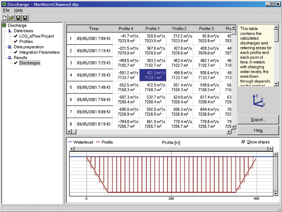
- The discharge module calculates flow rates at each time, on each of your user defined cross section
Features
- Conditioning module for ADCP data import
- LOG_aFlow evaluation module
- Discharge calculation module
- Online tutorial
- 1 year update service and hotline support
- Several standard Windows export file formats for presentation purposes and easy comparison of time based studies
- Clear and transparent graphics and comprehensive overviews
- The Discharge Module calculates flow rates at any time, on each of the user defined cross sections
Options
- Discharge measurement
Applications
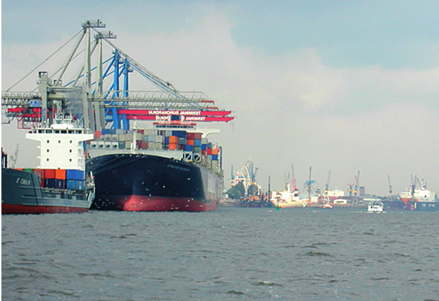
• Flow measurements in harbours, rivers and coastal zones, optimal in tidal waters
• Pilot assistance for ship maneuvering
• Assisting surveying in hydraulic engineering
• Environmental monitoring
• Optimising the choice of location for fish farms in aquaculture industries
• Optimising the location for standard / long-term discharge measurement tracks/profiles
• Validation of discharge measurings in unsteady / turbulent flows or at changing water levels
• Measurements at river junctions or floods
• Estimation of sediment transport, erosion and deposition zones in combination with SUBPRO1210 SBP/SBE
• Discharger measurement
• Calibration of discharge hydrographs