LOG_aLevel Long Range – Tide Gauge
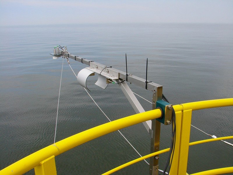
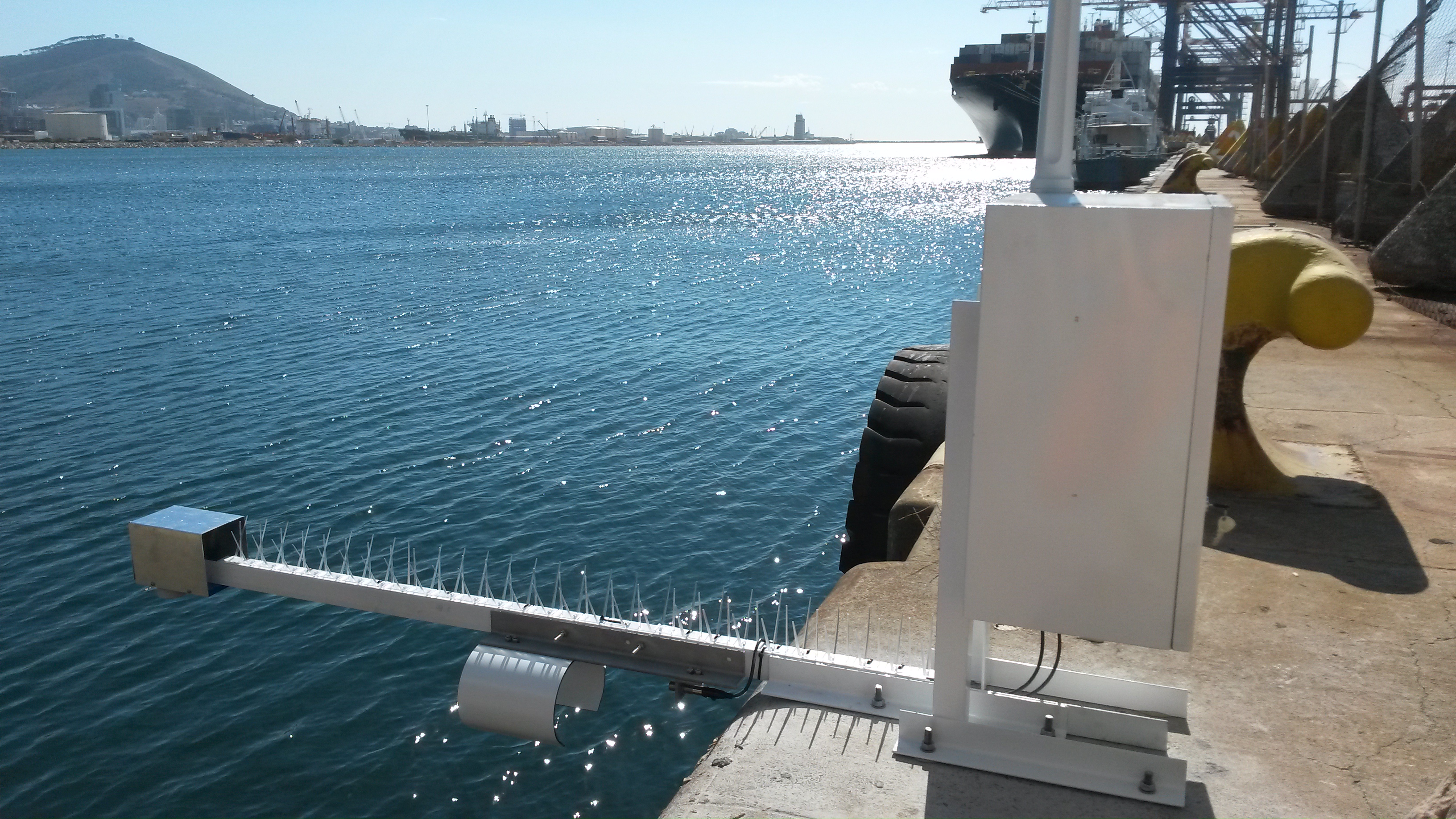
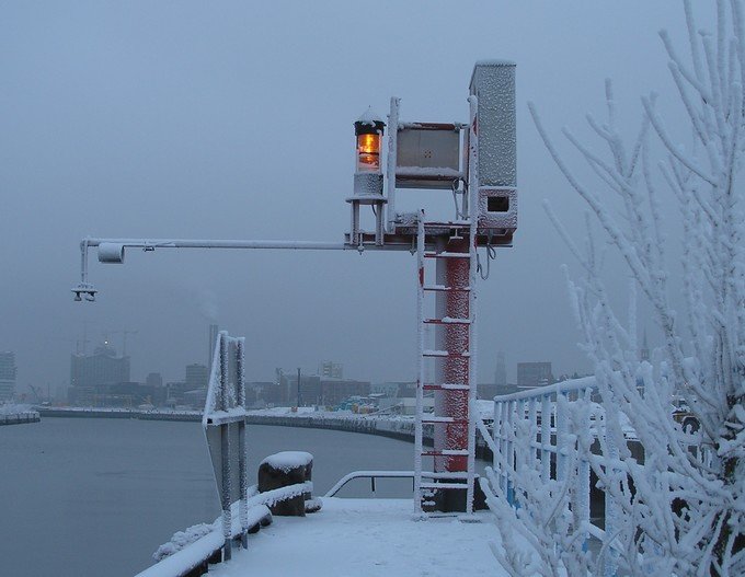
LOG_aLevel Long Range is a remote sensing, reliable and low maintenance Long Range Tide Gauge (water level gauge). The system can work with ultrasound or Radar sensors. Measurement ranges up to 50 meters are possible.
It is extremely robust & reliable and is used for precise measurements of all kinds of water levels and wave dynamics (up to steep waves). LOG_aLevel can be easily extended to include a datalogger, data communication systems and additional hydrological and meteorological system to form a complete monitoring station. Furthermore, multiple LOG_aLevel stations can be interconnected to form a network. Integration in SCADA systems is straightforward.
For a stationary Tide Gauge with a measurement range up to 10 meters, or using pressure sensors, please see LOG_aLevel.
For a mobile Tide Gauge please see LOG_aLevel Mobile.
Talk to us for your need in Wave Direction Measurements. We can provide systems for inland, coastal, offshore and laboratory applications!.
Advantages
- Easy to install and integrate into SCADA systems
- Cost effective
- Extremely Robust & reliable
- Used in Offshore Oil, Gas and Wind Energy Platforms around the World
- Calibration-Free
- Maximum Accuracy at all times
- Maintenance-Free (no moving parts, remote sensing)
- Reliable under Extreme Conditions: Flood, Ice, Storms, Debris, etc.
- Narrow Ultrasound Beam for Accurate Level even at Wavy Water Surface
- Simultaneous Wave and Level Measurement
- Extension With Additional Sensors (Redundancy, Meteorology and Hydrology)
- Remote Data Transmission, Control and Alerting
- Easy Integration to Measuring Networks
- Reduced risk of malfunction in case of flood and ice (no frozen level gauges!)
- Fast measurements (measurement of steep waves is possible)
- Remote sensing without influence to water surface
Features
- Continuous speed of sound measurement with Reference sensor REF-300 ensures an always accurate, calibration-free system (applies to systems with ultrasound sensors)
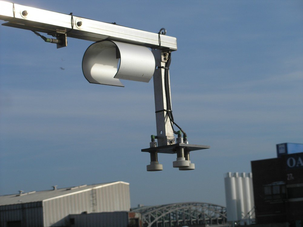
- Housing: 300x400x200mm or 500x500x200mm stainless steel with lock, seawater resistant IP class up to 67
- Mounting of Sensors: Seawater resistant pole (stainless steel) with mounting plate
- LOG_aLevel Windows Software for system set-up, analysis of measuring network, visualization, managing, storing and exporting of data
Specifications
Measuring range: 15, 20, 25, 30 m (ultrasonic) 40 m (radar) Sample rates: up to 5 Hz Resolution: 1 mm Accuracy: 2 cm Power supply: 24 VDC ( 230/110V AC optional) Data output RS232 or RS485 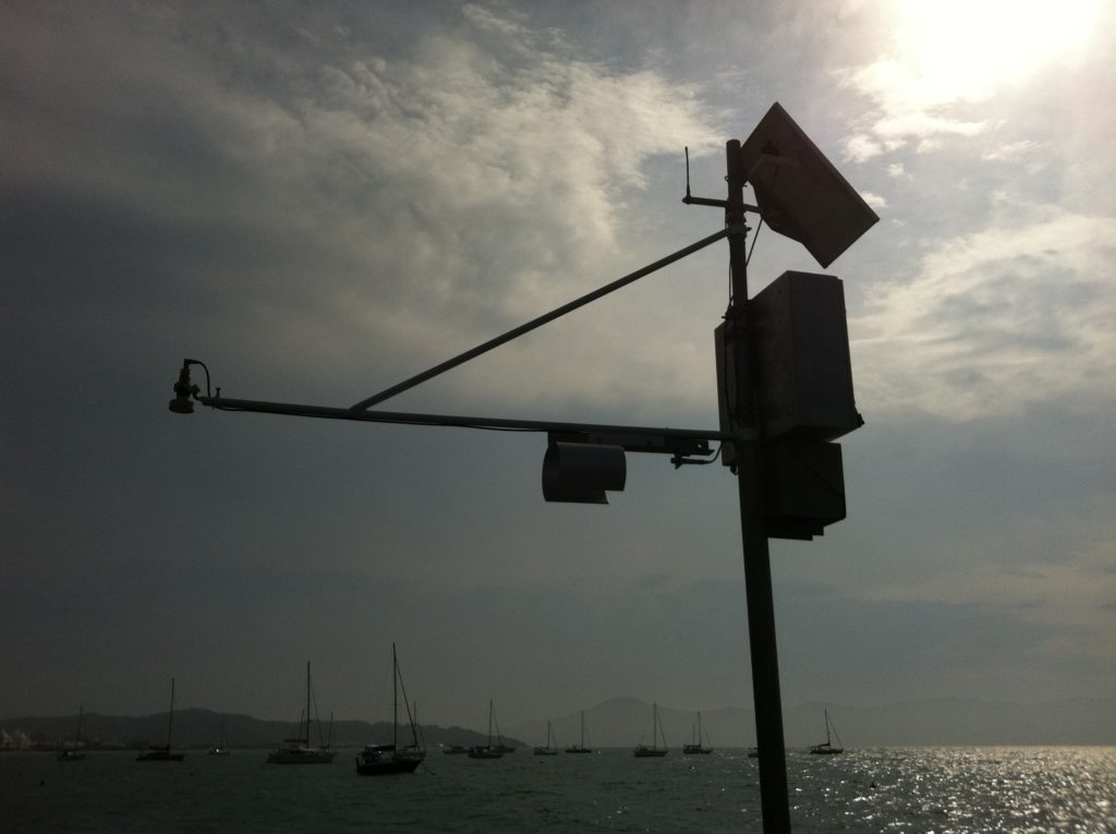
Options
- Ultrasound and Radar Sensors (see table below for details)
- Power autonomy: Backup battery up to 200 Ah, Solar Power, Wind Power
- Data logger with SD memory card (4GB / 8GB)
- Data transmission: Radio, GPRS, Satellite, Cloud, AIS, AIS AtoN
- Integration of any desired Hydrological and Meteorological Sensors (also in data stream, visualization and logging)
- Example Hydrological sensors: Water temperature, Inductive current meter, ADCP, Surface Current Flow, CTD, Salinity, Conductivity, Dissolved Oxygen, etc.
- Example Meteorological sensors: Wind gauge, Air temperature, Humidity, Rain, Ice, Solar Radiation, Barometric Pressure, Cloud Height, Visibility, complete Weather Stations and sensors for Helidecks, etc.
- ATEX (Ex Zone) Sensors and complete LOG_aLevel System for use in environments with an explosive atmosphere
- Time: High accuracy GPS – date and time (pps, 1ms accuracy)
- Data Server / Database
- Website
- Alerting / Early Warning System
- Tide Analysis and Prediction (please see TidePrediction Software)
- Hypack – Export or Data Stream
- Interfaces: LAN (fiber optic or RJ45), Modbus RTU or TCP
- Various Sensor bracket designs
- Additional wave parameters, wave spectra
Measurement Range: Ultrasound Sensor: Maximum distance from Sensor to Water: 30 meters
Radar Sensor: Maximum distance from Sensor to Water: 50 meters (larger ranges possible)
Applications
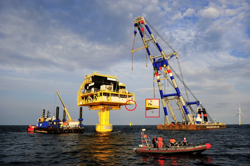
- Operation of Offshore Platforms
- Support of Offshore Construction Work, Offshore Maintenance and Surveys
- Optimization and Safety of Transport and Construction
- Wave Monitoring and Analysis
- Integration into or extension to a complete Met station
- Load Determination for Offshore Constructions
- Event Alerting System
- Hydrology and Environmental Monitoring
- Local Tide Analysis and Prediction
- Storm Tide, Flood and Tsunami Measuring Networks
- Real-Time Data for Vessels through AIS/AtoN
- Wave Measurements from Jack-Ups and Rigs
- Water Reservoir Management and River Monitoring from Bridges
Documents
Case Studies and Publications Brochures and Presentations LOG_aLevel® for Tsunami Presentation Case Study River Vienne/France Presentation Case Study North Sea/Germany Monitoring Network Tender Case Study Windpark Monitoring System Case Study Offshore