best in class resolution and sediment penetration
SUBPRO1210
The SUBPRO1210 is a state-of-the-art high-frequency, high-power survey system, optimised for shallow waters allowing survey at depths as shallow as 1.5m. The sediment echosounder has high-resolution on sediment penetration. It´s typical seabed penetration is up to 10m in sand.
For a portable Sub Bottom Profiler, suitable for AVS (small vessel) operation and ultra shallow water survey, please see: SUBPRO2545
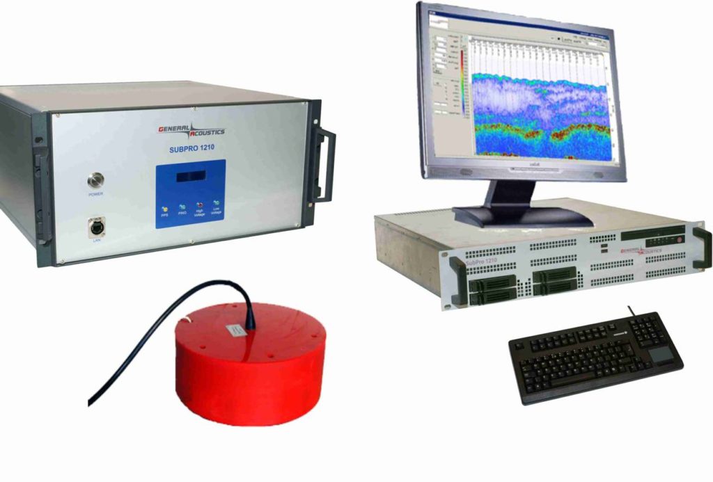
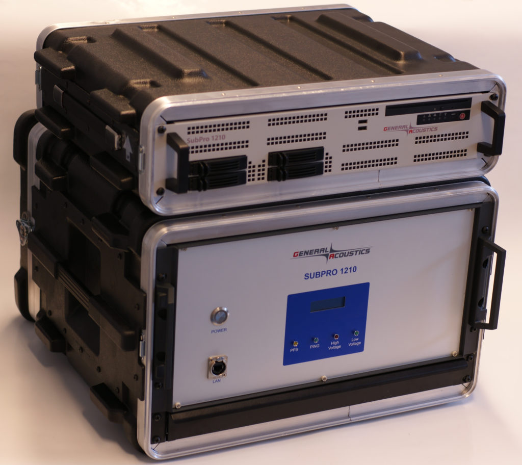
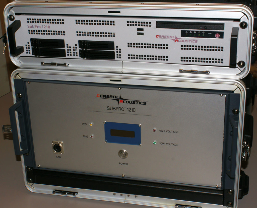 SUBPRO 1210 consists of a controller unit and a high-performance PC in 19” housings. The complete system incorporates the controller for triggering, transmitting, receiving, amplifying and processing of signals, analysis unit, pps-module for time synchronization and power supply.
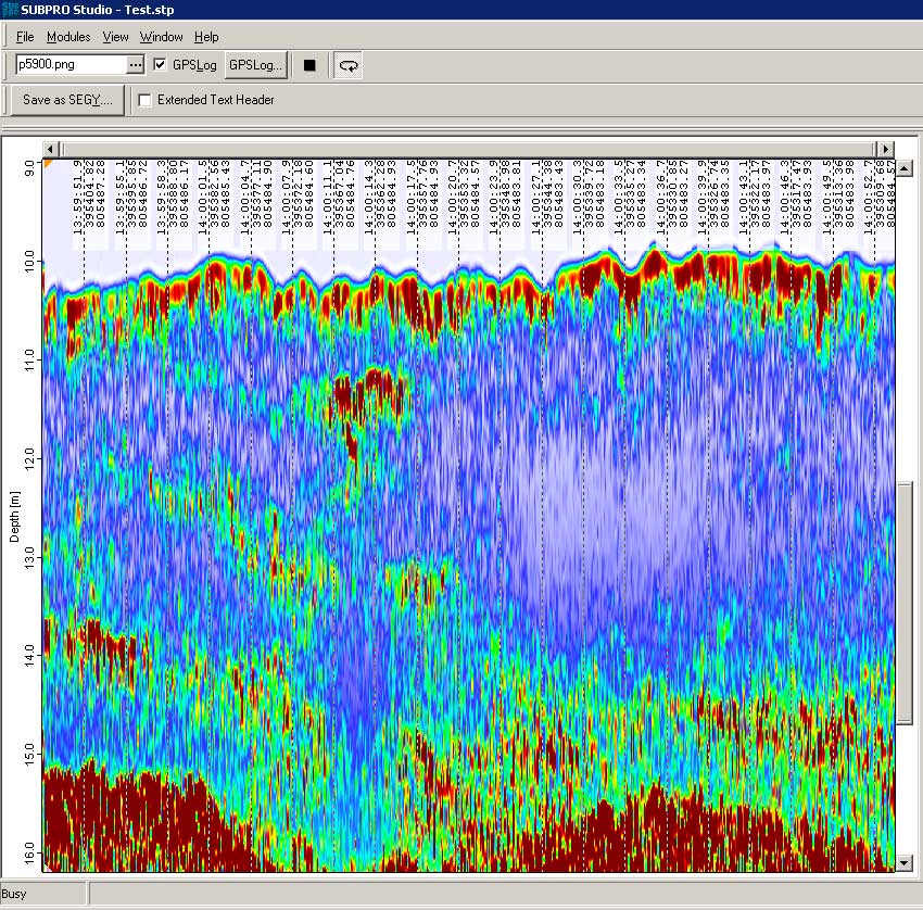
The PC unit includes the storage of raw files, results and project files, TFT monitor and easy to handle WINDOWS® software SUBPRO Studio for re-/post-processing and export of data.
Specifications Type Piezo Electric Maximum Power Output Up to 10 KW peak Transducer Beam width 10° Frequency 12 kHz / 25-45 kHz wideband Max Firing /Repetition Rate 20 Hz Pulse length max & min 200 µs – 1 ms Resolution 1 mm Typical penetration up to 10m in Sand >10m in soft sediments Input and Output Hard Copy Printer Supported – Windows printer Output formats – SEG-Y, XTF (optional), Ethernet, Printer, DVD-R – Ethernet, CD-R/DVD-R Input devices – pps time (NMEA) for HRP adjustment
– GPS (NMEA)
– Heave, Pitch, Roll (optional)Data Storage – Saving of high resolution RAW data and
project data
– Post processing on RAW data possible via
EthernetTransducer Weight in Air – 35/30 kg Size – Ø 380 mm , 165 mm high Depth rating – 500 m Mounting – Hull mounted, Over-the-side mounted Controller Specs and PC Unit SNR and Dynamic range – > 160 dB Weight in Air of surface equipment – 25 kg Size H/W/L – 19″ Rack, 50 x 50 x30 cm Power Supply – 110 VAC / 230 VAC Weight in Air of surface equipment – 30 kg Technical internal resolution 24 bit / 1 mm High Performance Quad-Core PC 19″ Rack, 50 x 50 x 25 cm, 20 kg Transmit Power up to 10/4 kW peak 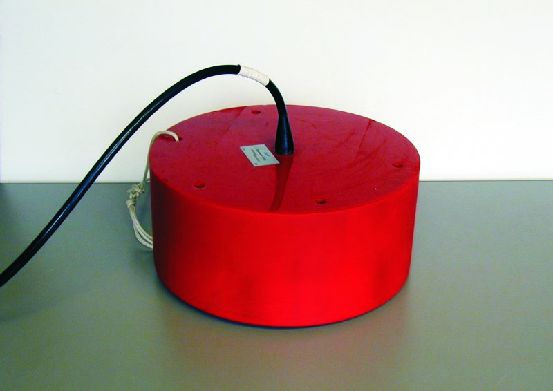 Transducers: 12 kHz (standard) / 25-45 kHz wideband (optional) / transducer arrays and custom systems for specific applications.
- subsoil exploration
- (Buried) pipeline, cable and object detection
- Offshore hazard surveys
- Dredge, mining and dump monitoring
- Very shallow water surveys
- High-sediment load surveys
- Volume determination (e.g.for sand reclamation)
- Scour detection and monitoring
- Environmental surveys
- Archaeological surveys
- Sediment transport investigations
- Sediment monitoring for jack-up deployment
- Validation and extension of hydrographic surveys at soft sediments and highly concentrated suspensions
- Sediment density profiling
Application examples More Examples Datasheet
Survey Port of Aberdeen
Detection of contaminated Sediment
Datasheetcontaminated Sediment
Sand detectionCable detection