Water level & Wave Measurement
LOG_aLevel – Water Level Gauge
LOG_aLevel is a remote sensing, stand-alone Water Level Gauge (Tide Gauge). The system can work with ultrasound, radar or pressure sensors. It
is extremely robust & reliable and is used for precise measurements of all kinds of water levels and wave dynamics (up to steep waves).The system can be easily extended to include a datalogger, data communication systems and additional hydrological and meteorological system to form a complete monitoring station. Furthermore, multiple LOG_aLevel stations can be interconnected to form a network. Integration in SCADA systems is straightforward.
Advantages
- Easy to install
- Cost effective
- Extremely Robust & reliable
- Calibration-Free
- Maximum Accuracy at all times
- Maintenance-Free (no moving parts, remote sensing)
- Reliable under Extreme Conditions: Flood, Ice, Storms, Debris, etc.
- Narrow Ultrasound Beam for Accurate Level even at Wavy Water Surface
- Simultaneous Wave and Level Measurement
- Extension With Additional Sensors (Redundancy, Meteorology and Hydrology)
- Remote Data Transmission, Control and Alerting
- Easy Integration to Measuring Networks
- Reduced risk of malfunction in case of flood and ice (no frozen level gauges!)
- Fast measurements (measurement of steep waves is possible)
- Remote sensing without influence to water surface
Features
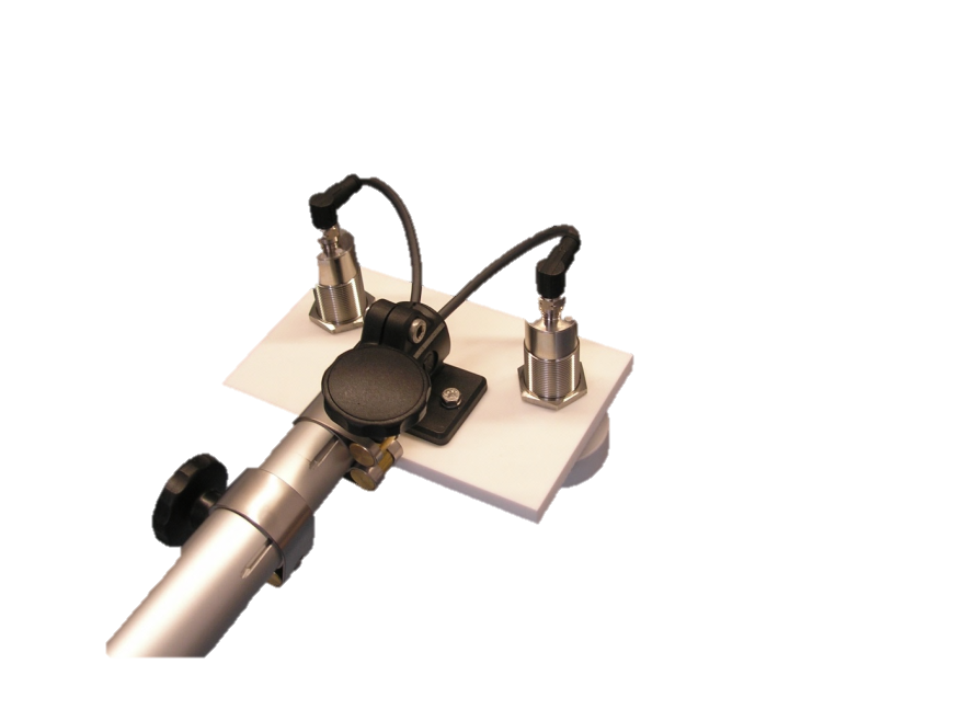
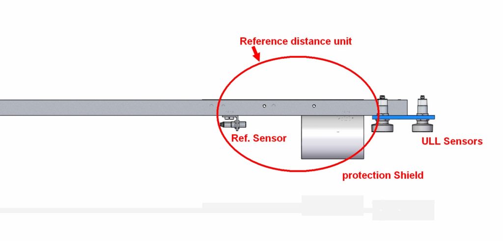
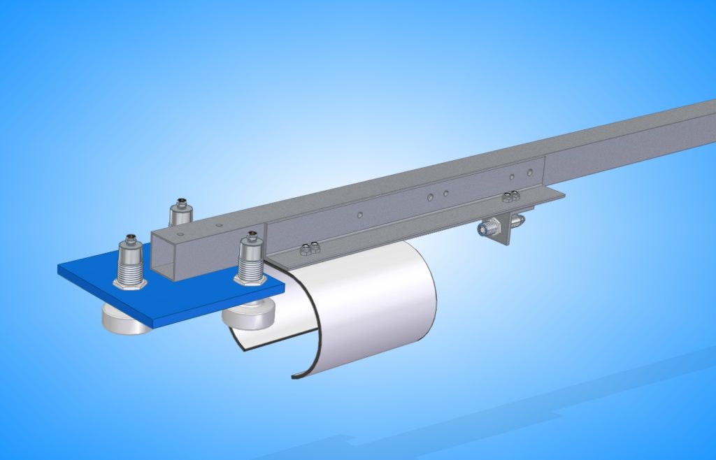
- Continuous speed of sound measurement with Reference sensor REF-300 ensures an always accurate, calibration-free system (applies to systems with ultrasound sensors)
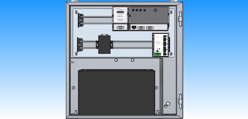
- Housing: 300x400x200mm or 500x500x200mm stainless steel with lock, seawater resistant IP class up to 67
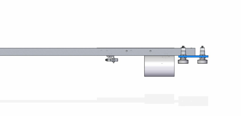
- Mounting of Sensors: Seawater resistant pole (stainless steel) with mounting plate
- LOG_aLevel Windows Software for system set-up, analysis of measuring network, visualization, managing, storing and exporting of data
Specifications
Measuring range: depends on sensor technology (Ultrasound, Radar, Pressure)
Sample rates: up to 5 Hz
Resolution: 1 mm Accuracy: 1 cm Power supply: 12 VDC ( 230/110V AC optional) Data output: RS232 or RS485 Working temp: -20°C up to +70°C 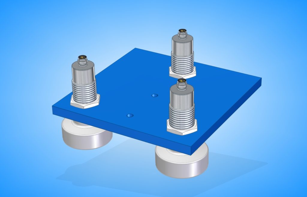
Options
- Ultrasound, Radar and Pressure Sensors (see table below for details)
- Power autonomy: Backup battery up to 200 Ah, Solar Power, Wind Power
- Data logger with SD memory card (4GB / 8GB)
- Data transmission: Radio, GPRS, Satellite, Cloud, AIS, AIS AtoN
- Integration of any desired Hydrological and Meteorological Sensors (also in data stream, visualization and logging)
- Example Hydrological sensors: Water temperature, Inductive current meter, ADCP, Surface Current Flow, CTD, Salinity, Conductivity, Dissolved Oxygen, etc.
- Example Meteorological sensors: Wind gauge, Air temperature, Humidity, Rain, Ice, Solar Radiation, Barometric Pressure, Cloud Height, Visibility, complete Weather Stations and sensors for Helidecks, etc.
- Time: High accuracy GPS – date and time (pps, 1ms accuracy)
- Data Server / Database
- Website
- Alerting / Early Warning System
- Tide Analysis and Prediction (please see TidePrediction Software)
- Hypack – Export or Data Stream
Measurement Range: Ultrasound Sensor Maximum distance from Sensor to Water: 10 meters (for larger ranges please see LOG_aLevel Long Range) Radar Sensor Maximum distance from Sensor to Water: 10 meters (for larger ranges please see LOG_aLevel Long Range) Pressure Sensor: Maximum depth: 50 meters
Applications
- Water level and tide monitoring
- Coastal protection
- Harbor and Terminal Management
- Storm Tide, Flood and Tsunami Measuring Networks
- Hydrology and Environmental Monitoring
- (Temporary) Level Gauge to Support Dredging, Surveying and Construction Works
- Spectral Wave Energy Analysis for Optimal Survey Quality
- Water/Fluids Reservoir Management
- Wave Monitoring and Analysis
- Ship Induced Waves
- Load Determination for Hydraulic Engineering
- Torrent Monitoring
- Local Event Alerting e.g. Flood, Tsunami
- Real-Time Data for Vessels through AIS/AtoN
- Local Tide Analysis and Prediction System together with Tidepredictor Software
- Wave Measurements from Jack-Ups and Rigs
- Server-based Fleet Management Networks incl. Web Portal (e.g.Ferries, Water-Planes, Supply Vessels)
- Discharge Hydrographs
- Flood warning
Downloads
Case Studies and Publications Brochures and Presentations LOG_aLevel® for Tsunami Presentation Case Study River Vienne/France Datasheet Case Study North Sea/Germany Tsunami II Presentation Survey Support System Application Monitoring Network Tender Case Study Aquaculture Case Study LL Radar